Following the minor flood warning issued on Monday 15 July, a moderate flood warning has been issued for the Yarra River between Warrandyte and Millgrove as well as the Watts River into Wednesday as the rain continues to fall in the Yarra Ranges.
A minor flood warning remains for the Yarra River up to Millgrove.
The Yarra River catchment has recorded rainfall averaging about 52 mm in the upper part of the catchment and about 25 mm in the lower part of the catchment since 9am Monday 15 July 2024. Rainfall totals of 10-20 mm was forecast for the upper catchment for Tuesday 16 July 2024.
The Watts River catchment has recorded rainfall averaging about 67 mm since 9am Monday 15 July 2024. Rainfall totals of 10-20 mm is forecast for the catchment for Tuesday 16 July 2024.
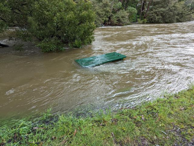
Water levels of the Yarra River and Watts Rivers at various locations are rising in response to the rain. Moderate flooding in the Yarra River catchment is expected to cause substantial inundation in the rural areas, and disruption to traffic. Melba Highway at Yarra Glen is expected to get flooded and is already closed between Coldstream and Yarra Glen.
Yarra River from Millgrove to Coldstream:
The level of the Yarra River at Coldstream is currently at 3.94 metres, exceeding the Minor Flood Level (3.80 metres), and rising. It is expected to exceed the Moderate Flood Level (5.10 metres) overnight.
Yarra River from Coldstream to Warrandyte:
The level of the Yarra River at Yarra Glen is currently at 3.72 metres, below the Minor Flood Level (4.10 metres), and rising. It is expected to exceed the Moderate Flood Level (4.60 metres) on Wednesday 17 July.
Watts River:
The level of the Watts River at Healesville is currently at 2.92 metres, exceeding the Minor Flood Level (2.80 metres), and falling. It peaked just below the Moderate Flood Level (3.20 metres) this morning.
Impacts:
Flooding above floor level of a single-story home is likely to occur in some locations.
Heavy rainfall may lead to an increased risk of landslides – be aware of fallen earth, rocks, debris or trees.
Main roads and bridges may be closed due to flooding.
Check the VicTraffic website (traffic.vicroads.vic.gov.au) for road closures and follow instructions from emergency services.
High river levels and potential flooding in areas close to rivers and streams.