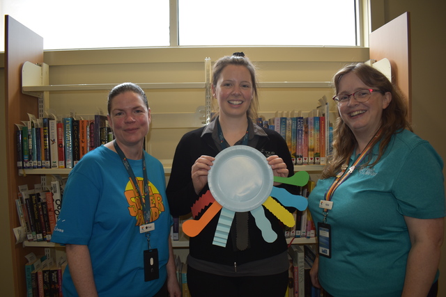
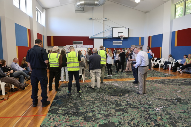
Key community players across the Yarra Ranges gathered in Belgrave on 14 November to participate in a unique exercise being run nationally on disaster preparedness.
The Yarra Ranges Council (YRC), in partnership with Disaster Relief Australia (DRA), hosted representatives from Warburton to Upwey and over 80 stakeholders, some from opposite ends of the Yarra Ranges, gathered for the session.
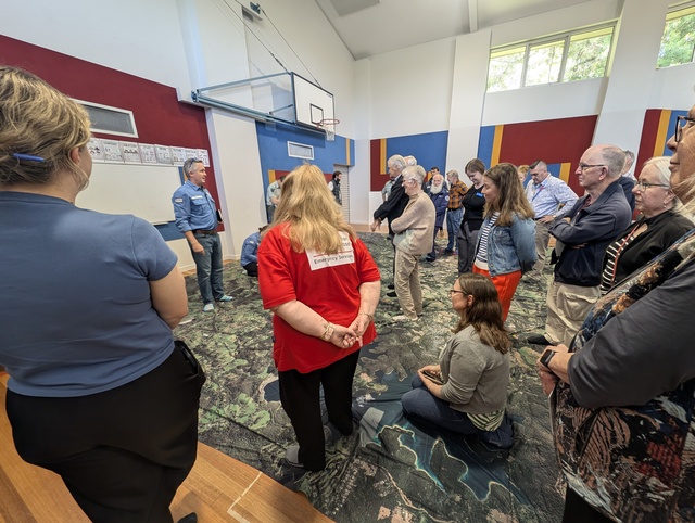
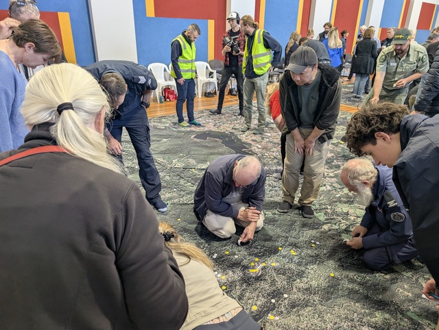
Clad in their socks, the groups began the day with introductions, then people began to walk across a printed fabric map of the region they live, work and respond in.
A representative from Disaster Resilience Australia led quite open conversations to draw out local information from several different perspectives.
Yarra Ranges Council Director Communities, Leanne Hurst, said on the day, the simulated scenario of a catastrophic fire event sparked some rich dialogue on roles and responsibilities in an emergency, as well as how decisions are made across the response, relief and early recovery phases of an emergency.
“The Big Map provided us with a unique perspective of the hazards and risks we all live with, so it’s a powerful tool that is linking agencies with the community, to help strengthen those relationships while also building awareness,” she said.
Community members, including Upwey High School students, contributed great insights on their recovery priorities and asked direct questions of agencies.
With a large contingent of people having freshly moved to the Yarra Ranges in the last five years, it means some people haven’t been through major bushfire or flooding events at all – the number given was around 35 per cent of the population.
Representing CFA in Kalorama, long-term fire brigade member Virginia Porter said she thought it was an excellent exercise and highlighted the extent of our risk areas across the ridgetop.
“The communication between the various agencies and community groups was paramount and highlighted the different priorities in an emergency situation,” she said.
With the bigger picture being the recurring theme, organisations like CFA, SES, Yarra Ranges Council and more, ran through the scenario, with smaller non-government-led agencies like township groups, radio stations and food relief groups chipping in with their own priorities and the realities of things that could be happening on the ground.
“The exercise showed that, as agencies, we need to focus more broadly and connect with the community to increase the benefits of the work we all do,” said Ms Porter.
The whole day continuously touched on the mental strain that is placed on the community when big climate and emergency events happen, and the necessity of having a safety net and proper coordination between the council, emergency services, and community groups to ensure effective response and support.
In the first days of an event, it was asked, How would people communicate? Check on their neighbours. Would family violence go up? Would schools go back? How are vulnerable and single-parent households coping?
Vice President of the Millgrove Residents Action Group (MRAG), Phil Pomaroff, said the exercise was a unique and interactive way to gain a better understanding of the place community lives.
“Importantly, the surrounding areas as well,” he said.
“Placing dots across the location of critical infrastructure around us, such as roads, bridges, telecommunications, emergency services, and community assets, the map gave insight into precious resources that could be drastically impacted by fire and flooding in extreme weather events,” he said.
“We learnt how all the emergency management services need to work together and how the community can play its part in a mock disaster scenario.”
Anecdotally, the facilitator mentioned that in times of disaster, there will always be community members who will step up and naturally create support for others.
Belinda Young from Mothers of the Hills was present on the day and said via social media that being part of this community-wide conversation was an important step in strengthening how our local families prepare and connect.
Lilydale SES Unit Controller Shaun Caulfield said the Big Map was an excellent way for community and emergency services, as well as support agencies such as the council.
“To connect with each other, in a unique way – it gives a unique perspective to the landscape, and was well facilitated, and ensured a wide range of community voices were heard by those that respond in different ways to emergencies and crises,” he said.
“It gives communities a sense of empowerment during a time when they can be at their most vulnerable.”
“The Big Map is a useful tool to engage with the community and help them better plan and prepare for any potential disaster,” said Mr Pomaroff.
Ms Hurst said, having now run this session with agencies and other stakeholders, Yarra Ranges has identified some enhancements that will be incorporated into a session for community members in the future.
The exercise hopefully creates real, actionable opportunities that will, in turn, be used to strengthen disaster resilience and improve emergency planning at a local level. Established in 2016, Disaster Relief Australia is a veteran-led not-for-profit that brings together the skills and experience of veterans and other dedicated volunteers to help communities prepare for and recover from disasters.
Big Map will hopefully be run for all community in early 2026 and will offer anyone who lives in the Yarra Ranges to learn and connect in a safe and productive way.
“We encourage anyone interested in learning more to keep an eye out for future events and to get involved,” said Ms Hurst.